
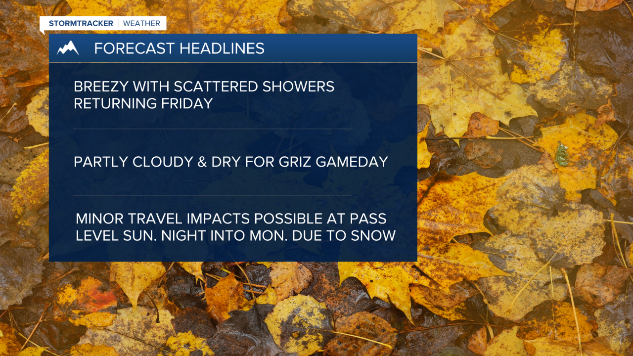
MISSOULA — A northwesterly flow on Friday will allow a few mountain snow and valley rain showers to develop with otherwise partly cloudy skies and highs in the low to mid 50s.
We’ll also see breezy conditions at times with wind gusts in the 20 mph to 30 mph range.
Watch the forecast:
Saturday will feature dry conditions with a partly cloudy sky and highs in the mid to upper 50s.
Clouds will increase by the late evening as our next trough of low pressure approaches.
That trough will bring in widespread mountain snow and valley rain and gusty conditions at times.
As snow levels drop to around 4,500’-5,000’ by Sunday night, minor pass level travel impacts will be possible into early Monday.
Lolo, Lookout, Lost Trail & Marias passes could pick up an inch or two to upwards of 4” when all is said and done — maybe 4” to 8” in the highest terrain.
Valley highs will drop into the mid to upper 40s for Monday, with showers ending by late day.
Watch the 24/7 StormTracker Weather stream below:
