


MISSOULA - Warmer temperatures associated with a large ridge of high pressure across the southwestern U.S. have made their presence felt up here in the northern Rockies! Several locations in the state have already experienced record highs ranging from the mid 60s to low 80s the last few days! Missoula had a record high of 71° Thursday and we had another Friday with 75°... and this is a bit early to see our first 70° day in Missoula! We typically don't do that until almost mid-April!
This unseasonably warm, dry and even windy weather through Friday will bring elevated fire weather concerns especially across southwest Montana.
An Avalanche Warning is in place for several ranges in northwest Montana into Saturday morning due to recent warmth and rain.

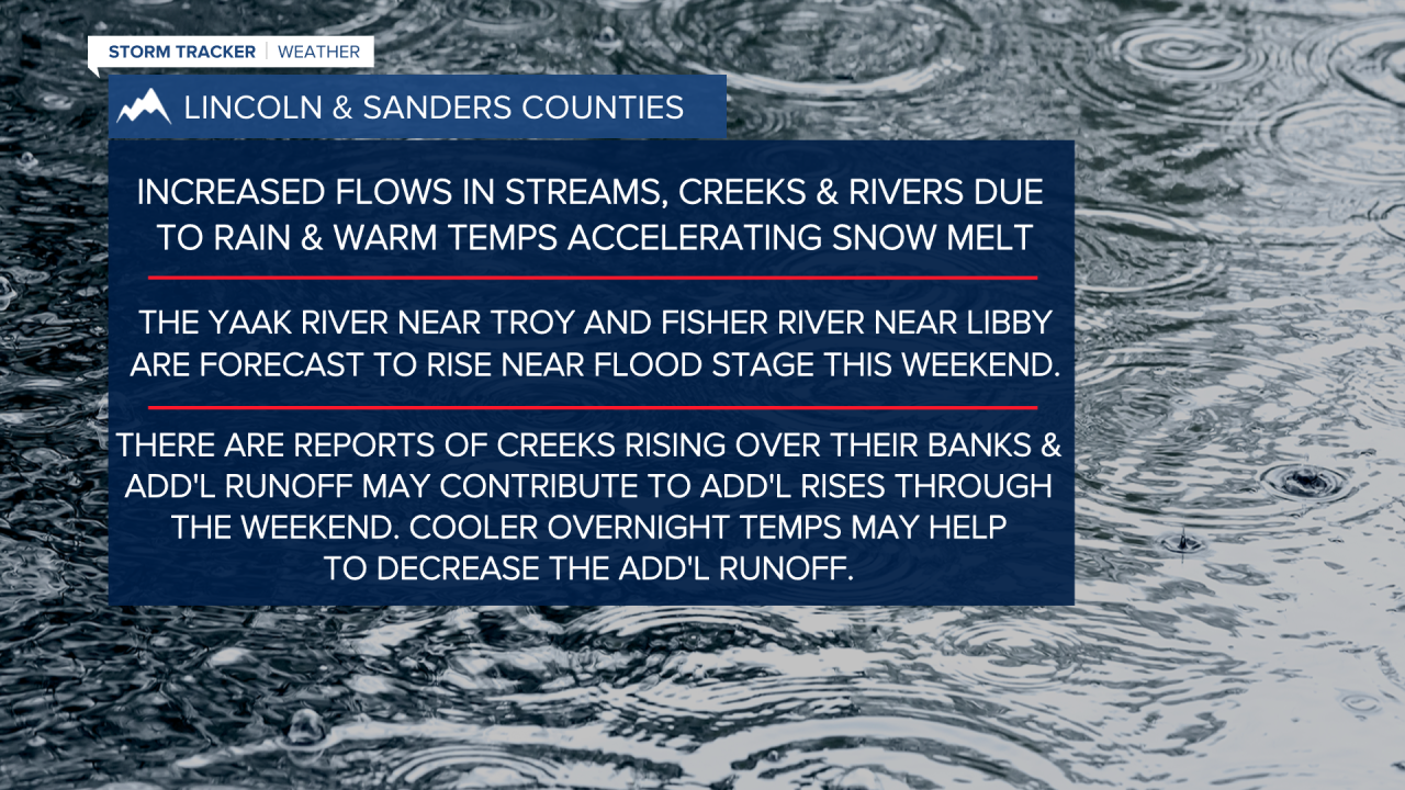
We've started (and will continue) to see slight rises on area rivers, creeks & streams. A Flood Watch is now in place for Lincoln County through Sunday morning. Minor flooding is already occurring: Ross Creek has swelled into nearby ditches and caused water to flow over Highway 56 south of Bull Lake. The Yaak River and Fisher River are forecast to reach action stage by Saturday night.

Showers will continue to spread from northwest Montana toward the southeast Friday night/Saturday morning with a cold front moving through. Expect breezy conditions and scattered showers with highs closer to normal in the low to mid 50s.
As of now, Sunday looks fantastic with mostly sunny skies and highs in the low 50s.
We'll see temps rise into the mid 50s to almost mid 60s Monday - Wednesday of next week before a potent cold front moves in late Tuesday/Wednesday with more rain and wind.
