


MISSOULA - The big weather story of the week is an incoming long duration, high intensity atmospheric river (AR) event late tonight lasting into early Saturday. This will bring strong & potentially damaging winds and significant precipitation.
The strongest winds are expected across northwest Montana and along the Continental Divide late Wednesday through Thursday with High Wind Warnings in place for much of the region.
As the AR continues to push into the region today, coverage and intensity of precipitation will increase. This will be a very wet system. As with most ARs, they originate in the subtropics and are warm systems. Normally, that would make for valley rain and mountain snow, but we have a secondary system/associated cold front that will track through on Thursday (hence the extreme wind). That throws a BIG wrench into whether or not valleys will see rain, a rain/snow mix or just flat out snow. It's looking more and more likely we'll trend towards snow for the valleys with a WIDE range of possible snowfall totals. The best bet for accumulation will be during the overnight hours and Friday/Saturday.
The mountains will see snow the entire time which will make for some SIGNIFICANT snowfall totals for this multi-day event... we're talking FEET of snow!
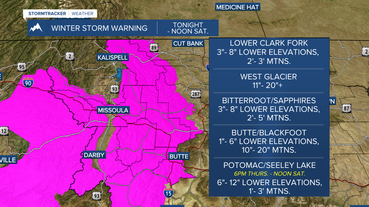
With that said, very difficult and incredibly dangerous backcountry conditions are expected due to strong winds and heavy snow, leading to localized blizzard conditions. Winter Storm Warnings and even a Blizzard Warning are also in place for this:

Needless to say, avalanche danger is on the rise considerably. Stay tuned as this is a very active and evolving system, but now is the time to prepare!
