MISSOULA — A plume of snow will continue to impact the region into Friday morning, although decreasing in intensity by morning/early afternoon.
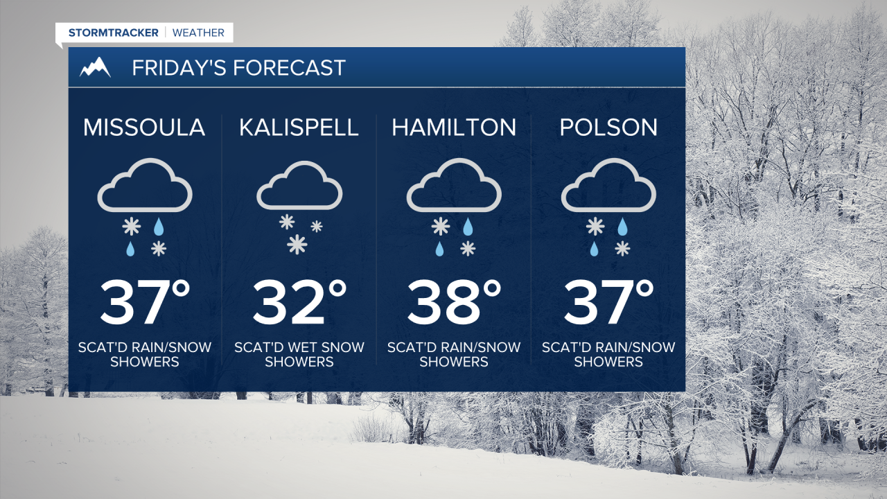
Highs on Friday will top out in the low to upper 30s, providing the opportunity for a rain/snow mix (especially the further south you go) in the valleys - mountains will remain all snow.
Watch the forecast:
Multiple ‘Winter Weather Highlights’ have been issued for moderate to major travel impacts: mountain passes will see heavy snow with reduced visibility and generally slick roads into Saturday and in the valleys, the potential for icy roads during the overnight hours as a re-freeze occurs.
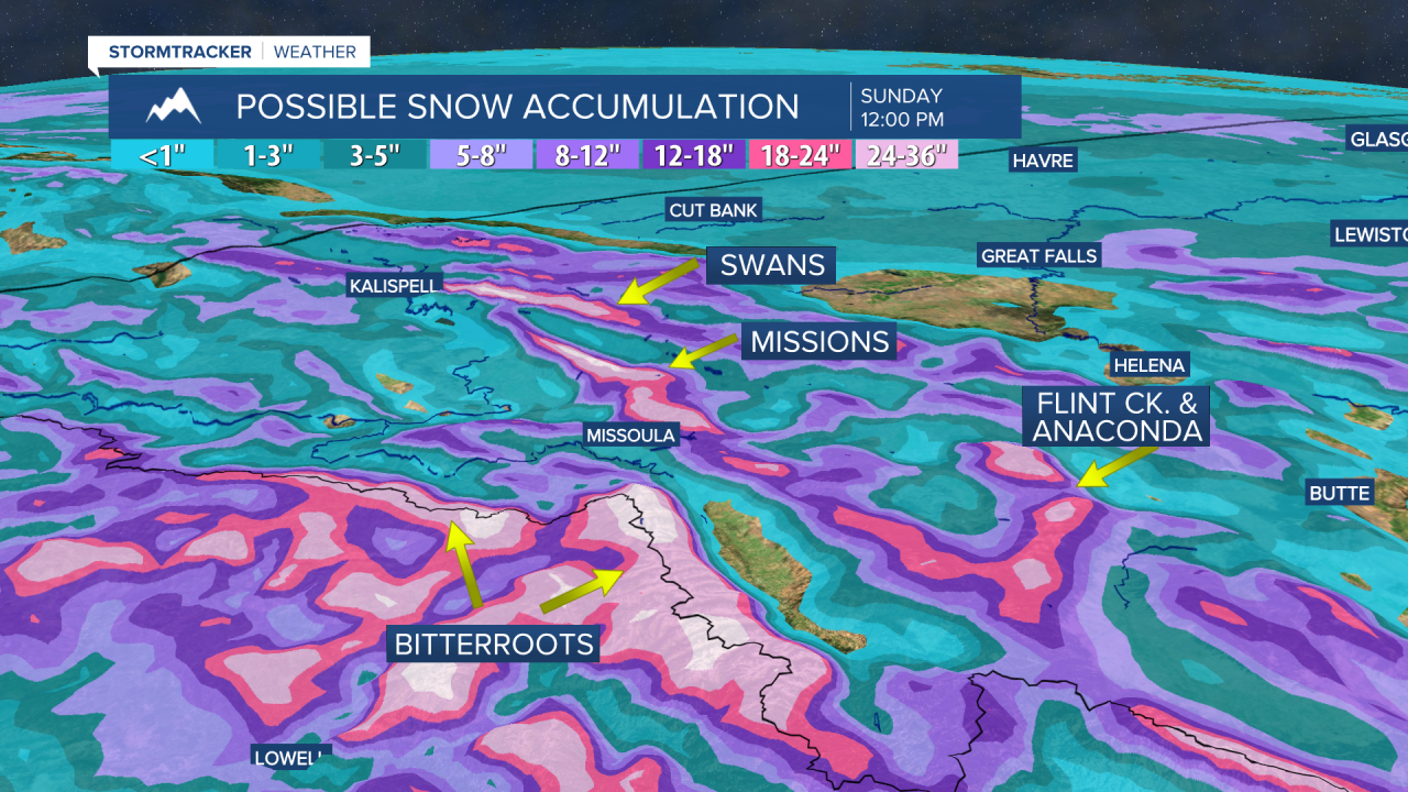
Precipitation intensity looks to pick back up Friday evening into Saturday as a heavier, secondary band moves in. Winds will increase with this influx of moisture. Highs will rise a little further into the upper 30s to around 40°. With the intensity of moisture expected, we could very well see some snowbands setting up, providing intense periods of wet snow.
Sunday afternoon into Monday will showcase more scattered mountain snow and valley rain as yet another surge of moisture works its way in. Highs should top out in the upper 30s to low 40s.
Models indicate the very active weather sticking around for much of next week, with highs possibly into the low to mid 40s for Tuesday.
Watch the 24/7 StormTracker Weather stream below:


