
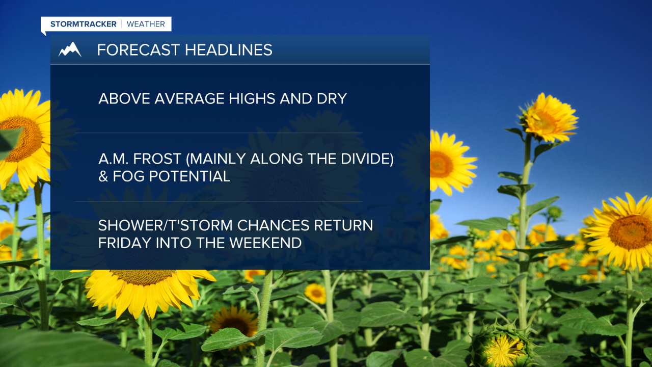
MISSOULA - High pressure continues to control the weather pattern on Wednesday with above-average highs in the upper 70s to mid 80s with loads of sunshine!
Watch the forecast:
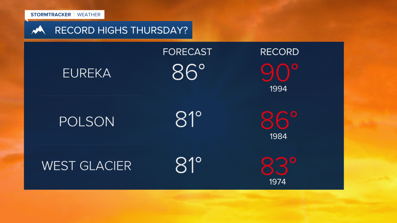
Expect more of the same Thursday and Friday, with patchy morning frost in the higher elevation valleys along the Divide and a few pockets of fog. Some folks will be in record high territory the next couple of days!
A weak disturbance will begin to flatten the ridge on Friday afternoon with a few more clouds and an isolated threat for late-day thunderstorms.
Saturday should showcase mainly sunny skies with highs in the upper 70s to low 80s.
Another slightly stronger disturbance will usher in cooler temps in the low 70s for Sunday, with a greater chance for a pop-up shower or thunderstorm and breezy afternoon winds. Expect choppy conditions on area lakes as gusts will be in the 25-35mph range.
As of now, more ridging is likely to kick off next week with warmer and drier conditions, but shouldn’t last long.
Watch the 24/7 StormTracker Weather stream below:
