


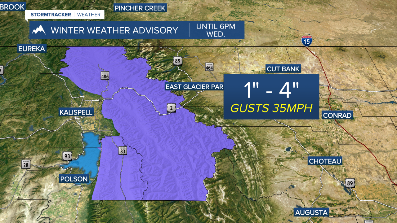
MISSOULA - The Northern Rockies will remain under a westerly flow running into Wednesday bringing breezy winds and off & on light snow showers... particularly in the West Glacier Region where a Winter Weather Advisory is in place through 6pm Wednesday.
The big weather story is an incoming long duration, high intensity atmospheric river (AR) event late Wednesday into early Saturday bringing strong & potentially damaging winds and significant precipitation.
The strongest winds are expected across northwest Montana and along the Continental Divide late Wednesday through Thursday with High Wind Warnings in place for much of the region.

As the AR pushes into the region on Wednesday, coverage and intensity of precipitation will increase along with the snow levels. This will be a very wet system. As with most ARs, they originate in the subtropics and are warm systems. While valleys along and south of I-90 look to remain all rain, some snow could mix in at times across northwest Montana with otherwise rain the main precipitation type (that looks to change to snow running into the Friday/Saturday timeframe with light accumulation likely). The mountains will see snow the entire event which will make for some SIGNIFICANT snowfall totals for this multi-day event... we're talking FEET of snow!
With that said, very difficult backcountry conditions are expected due to strong winds and heavy snow, leading to localized blizzard conditions. Winter Storm Warnings are also in place for this:

It's safe to say most valleys will pick up 0.50" to 1"+ of liquid precipitation for this event. While low lying areas prone to flooding and flooding in poor drainage areas are possible, no major flooding is expected for our rivers.
Stay tuned as this is a very active and evolving system, but now is the time to prepare!
