


MISSOULA - High pressure continues to remain over much of the western U.S., providing mainly sunny skies, dry conditions and above-average highs.
Those highs will top out in the upper 60s to mid-70s for Thursday and Friday, although clouds will increase Friday evening as a major pattern change begins to take shape.
Watch the forecast:
This upcoming weekend will showcase widespread mountain snow and valley rain as a Pacific trough of low pressure moves inland.
Snow levels will start off quite high Friday, around 9,000’ to 10,000’ and drop throughout Saturday. By Sunday morning, they could be as low as 4,000’.
Travel impacts are likely at pass level - perhaps even some lower elevations during Sunday & Monday mornings, although most of the valleys will remain mainly rain.
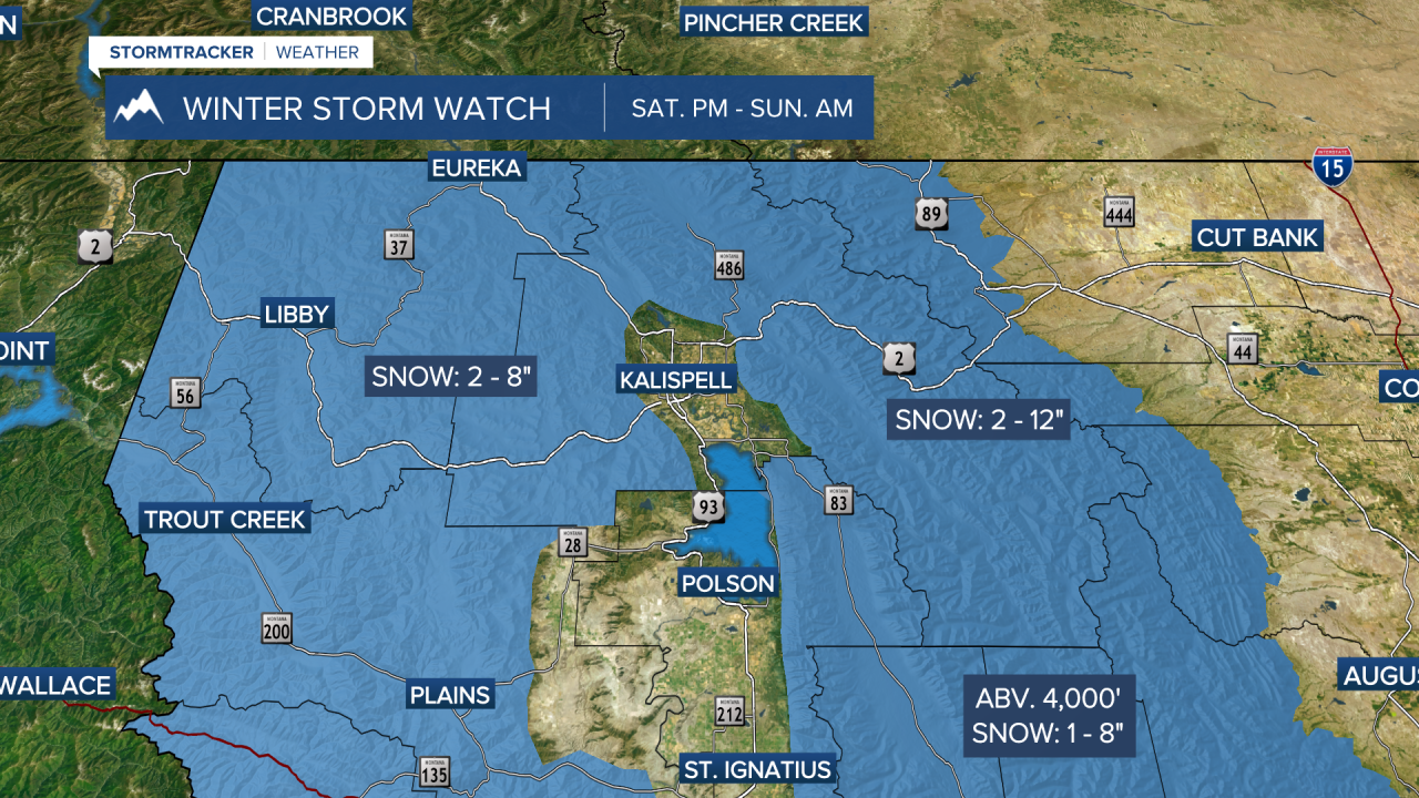
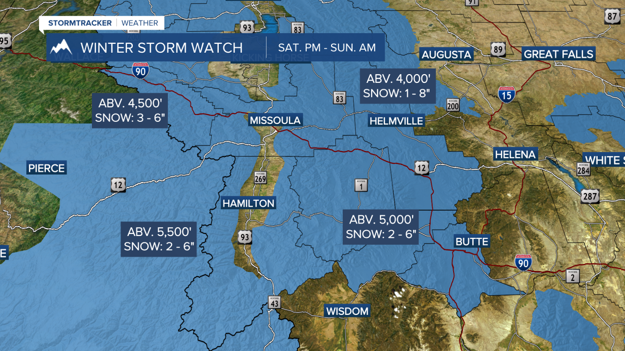
Winter Storm Watches have been issued for Saturday evening into Sunday morning as follows:
- Bitterroot/Sapphire Mountains (above 5,500’) for 2”-6” mainly Sula to Lost Trail Pass.
- Butte/Blackfoot Regions (above 5,000’) for 2”-6” over MacDonald & Homestake Passes and Butte/Georgetown Lake.
- Lower Clark Fork Region (above 4,500’) for 3”-6” over Lookout Pass.
- Potomac/Seeley Lake Region (above 4,000’) for 1”-8”.
- West Glacier Region for 2”-12”, including Badrock Canyon, Polebridge, Bigfork to Swan Lake with the high end falling in Glacier National Park.
- Kootenai/Cabinet Region for 2”-8” around Hwy. 37 Eureka to Libby, Hwy. 2 Kalispell to Libby and Hwy. 93 Whitefish to Eureka.
One concern is refreezing of melted snow on roadways during the overnight hours, causing slick conditions.
Valley highs look to drop into the upper 50s Saturday and mid to upper 40s Sunday and stay cooler into next week with more possible rain and snow.
This is an evolving system, so you’ll want to stay tuned for details as we get closer and the forecast becomes clearer.
Watch the 24/7 StormTracker Weather stream below:
