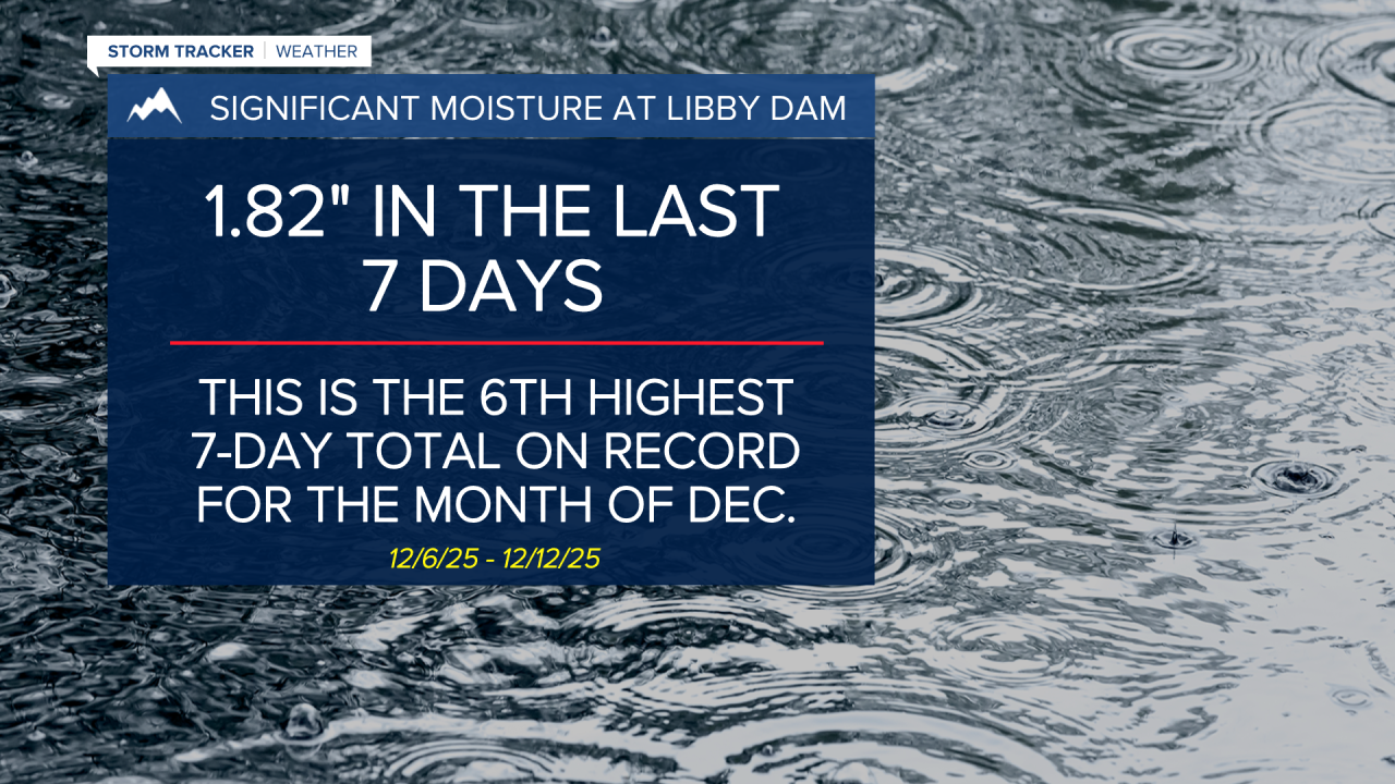
MISSOULA — Remnants of our recent Atmospheric River event will continue to impact the region into early Saturday with diminished intensity compared to midweek.
Watch the forecast:
Flooding appears to be improving across Sanders and Lincoln counties, but the rivers and streams will remain extremely high for another 24 hours. The rain that returns Friday afternoon and evening will be capable of putting down an additional 0.10” to 0.25”.
Cold air banked up — and seeping through — the Continental Divide/Rocky Mountain Front will keep the threat of snow across the West Glacier & eastern portions of the Potomac/Seeley Lake Regions.
A Winter Weather Advisory continues for the West Glacier Region through 5 a.m. Saturday for light accumulation.
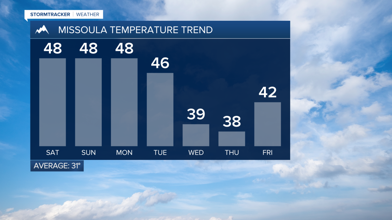
Elsewhere, above average highs in the 40s are expected with scattered rain showers.
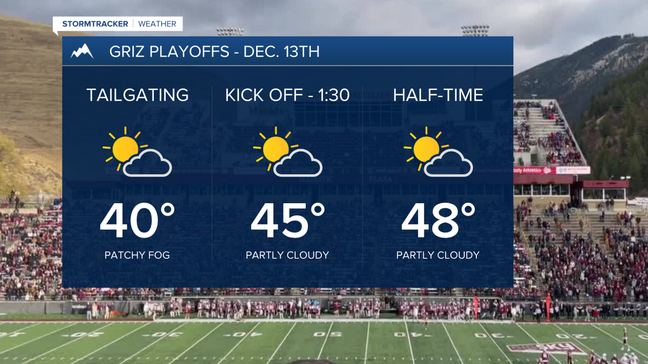
High pressure will build in this weekend, causing a drying trend. Valley inversions are expected to develop with a high chance of fog and low stratus clouds developing, too. Highs look to remain in the 40s.
The drying trend will only be temporary as the northern Rockies return to a very active weather pattern next week.
Another (weaker) Atmospheric River will provide a few shots of moisture: the first should arrive Monday afternoon and continue through Tuesday with snow levels above 7,000’. 1”- 2” of rain will be possible in northwest Montana, with 2”-3” in the mountains.
Hydrologic concerns, especially for the northwest, exist due to already saturated grounds. We’ll see an increased risk of rock/mudslides, sharp rises on area rivers/creeks/streams and minor flooding.
Moisture will continue to stream over the Northern Rockies behind a cold front on Wednesday, turning rain to snow down to valley floors for the rest of the week.
While 1 to 2 feet of snow is possible in the mountains, valley accumulations will vary significantly as most snow will fall in narrow bands.
We’ll keep an eye on this potential!

Watch the 24/7 StormTracker Weather stream below:


