


MISSOULA — After a lull overnight, we’re back at it again Thursday night into Friday as yet another surge of Pacific moisture accompanied by strong winds tracks through the region.
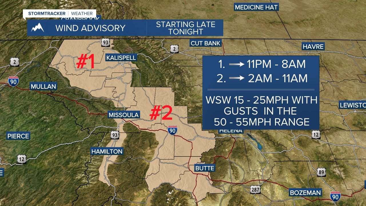
South to southwest winds with 35-55mph gusts are likely with isolated gusts approaching 60mph as this next front moves through. Areas of greatest concern include west central and southwest Montana (I-90 & Hwy. 93 corridors and the Mission Valley especially). Once again, the risk of downed trees, power outages and travel difficulties exists. Wind Advisories have been issued:
The bulk of moisture will be directed at the Bitterroot/Sapphire Mountains with Winter Storm Warnings (5pm Thursday - 5pm Friday) in place where travel is expected to become difficult (due to heavy snow and wind). Here we could see:
4,500’ – 6,000’, including Lolo Pass: 8”–16”
6,000’ – 7,500’, including Lost Trail Pass: 12”–24”
7,500’+ (Bitterroots): 24”–36”
Winter Weather Advisories have also been issued for the Lower Clark Fork & West Glacier Regions (now through 11am Saturday) for 6”-12” at Lookout & Marias Pass (heaviest above 6,000’). West Glacier itself could pick up 1”-4”.
Valleys will start off a snow, transition to a rain/snow mix ovvernight and then back to snow behind the front. Quick bursts/snow squalls will be likely Friday late morning/afternoon for mainly west central and southwest Montana.
The main plume of moisture shifts south and east by Friday evening with some sunshine to end the day across Northwest Montana. Highs will be in the upper 30s to low 40s Friday.
A cooler, unsettled westerly flow will keep mountain snow showers through the weekend - especially along the MT/ID border. As of now, valleys will remain somewhat active, too, but precipitation type may vary with above average highs expected.
