
MISSOULA - A quick-moving system will track across the region today with widespread showers, embedded thunderstorms and cooler highs — a good 5-10° below average.
Watch the forecast:
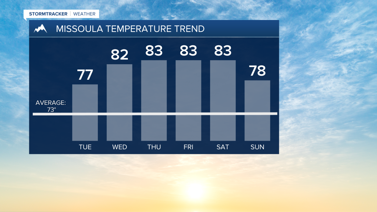
Patchy morning fog is likely (especially along the Hwy 93 corridor and westward) on Tuesday with quickly decreasing clouds as high pressure begins to build in. Highs will be in the mid-70s.

The National Weather Service is warning “gardeners beware as this is a sneaky time of year as longer nights under clear skies often cause overnight lows to be several degrees cooler than guidance may suggest”.
Watch for frost potential in the higher valleys along the Divide, along with common cold spots in the Bitterroot, Missoula and Flathead valleys. The chilliest nights look to be Monday and Tuesday.
High pressure will allow for generally dry conditions into Friday with above-average highs in the upper 70s to mid-80s into Saturday.
This weekend could showcase a southwesterly flow, ushering in a minor cool-down along with the development of showers and thunderstorms.
Watch the 24/7 StormTracker Weather stream below:
