MISSOULA — A prolonged atmospheric river event continues to bring periods of heavy rain & wind for the region and will for the rest of the work week.
Generally, snow levels are remaining fairly high, but they will lower Wednesday morning very briefly, allowing for wet, valley snow in mainly Northwest Montana and valleys along the Divide.
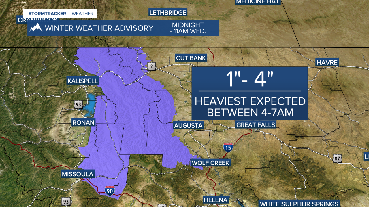
Winter Weather Advisories have been issued for the West Glacier & Potomac/Seeley Lake regions from midnight to 11 a.m. Wednesday. 1”-4” of snow will be possible, with the heaviest expected between 4 a.m. and 7 a.m.
Watch the forecast:
Snow levels quickly skyrocket to around 6,000'/7,000' on Wednesday afternoon. Highs for the valleys will be in the mid to upper 40s, if not low 50s, for a windy, Bitterroot Valley.
By Thursday, significant liquid precipitation totals are expected with anywhere from 1/2" to upwards of 4" in our valleys (highest where Flood Watches are in place) and 4” to 8” in the mountains (highest over mountain crests along the Montana/Idaho border and into Glacier National Park/the Bob Marshall Wilderness).
We continue to monitor flood concerns across the region: Landslides in areas of steep terrain and minor flooding in urban and poor drainage areas is already happening and remains a very good possibility moving into the next couple of days. Storm drains and ditches will likely become clogged with debris and we’ll continue to see sharp rises on area waterways.
A Flood Watch remains in place for Mineral, Sanders, Lincoln, Flathead & Lake Counties through Thursday afternoon, where some of our highest totals are expected.
Watch the 24/7 StormTracker Weather stream below:


