
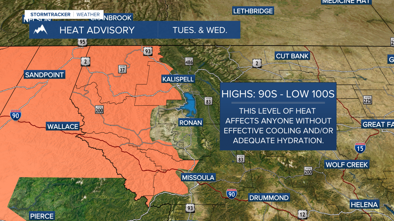
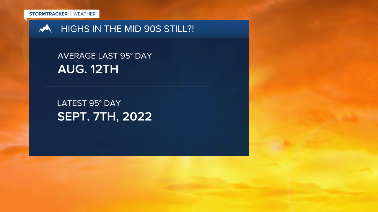
MISSOULA - Highs on Tuesday will top out well into the 90s across western Montana when we should be in the upper 70s, kicking off the month of September.
Watch the forecast:
Weather Forecast: 9.2.25
Parts of the Kootenai/Cabinet & Lower Clark Fork Regions continue to rise into the low 100s, which has prompted a Heat Advisory until midnight Wednesday.
Erin Yost
Erin Yost
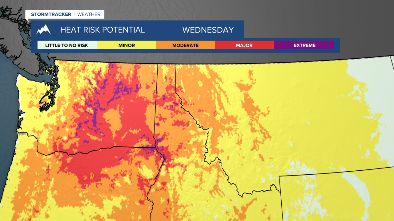
Not much of a change is expected through midweek. Hot, hazy/sunny and dry, but our ridge will shift a bit west, allowing for increased easterly winds Thursday into Friday.
Erin Yost
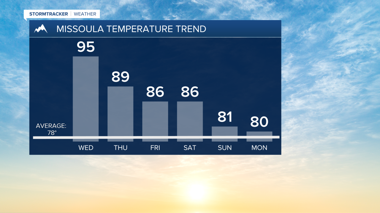
Right now, it looks like highs will come down closer to normal by late this weekend into early next week, with the chance of more cloud cover and scattered showers and thunderstorms.
We'll keep you posted.
Erin Yost
Watch the 24/7 StormTracker Weather stream below:
