
MISSOULA - The beginning of our pattern change has arrived!
Watch the forecast:
A Pacific trough of low pressure will slowly move inland into the Pacific Northwest over the next few days, bringing widespread, beneficial rainfall to the region.

Expect scattered showers and embedded thunderstorms for Tuesday, with a few peeks of sunshine from time to time.
The precipitation focus will shift into northwest Montana for Wednesday, with more clouds than sun otherwise.
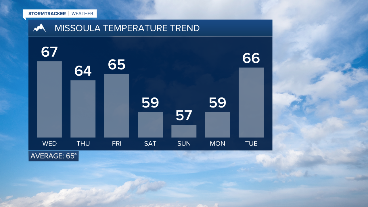
Highs will slowly trend downward throughout the week, too. Look for mid-60s Wednesday, low to mid-60s Thursday, low 60s Friday and possibly into the upper 50s for the weekend.
Something to note: if we see clouds breaking up enough (which is totally possible), there’s a chance for pockets of sub-freezing temps Thursday and Friday nights in low-lying valleys of Western Montana.
Models are hinting at another push of colder air this weekend as the trough moves into the Rockies. Depending on the exact track it takes, that will allow snow levels to drop down to about 5,000’ with light accumulation possible mainly along the Divide by Monday morning.
It's looking more and more likely we could also see our first freeze (not frost) for the season — particularly in the typical cold spots like Stevensville, Highway 93 north of Whitefish, Ovando, Georgetown Lake and Butte. We’ll keep you posted!
Watch the 24/7 StormTracker Weather stream below:
