


MISSOULA — Our persistently mild November will continue for a few more days, but all indications point to a major and abrupt pattern change arriving for Thanksgiving week.
Watch the forecast:
The National Weather Service office in Missoula says this will likely be the first widespread, low-elevation winter impact of the season.

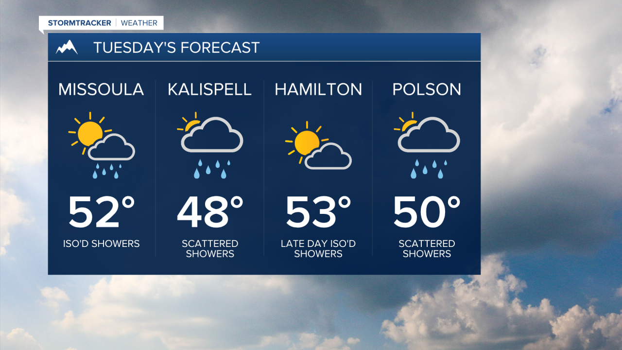
Until then, a few showers are likely Monday into early Wednesday for Western Montana (especially Northwest Montana) with highs well above average in the mid-40s to low 50s. Very light accumulations will be possible at pass level early Wednesday morning.
Patchy (locally dense) fog looks to develop during the mornings starting Wednesday and continuing through Friday as high pressure builds in. We’ll see a nice mix of clouds, sun and dry time otherwise. Again, highs will remain on the milder side in the 40s to low 50s.
This coming weekend, a larger surge of moisture looks to move in with slightly cooler temps arriving at the same time. If this holds, light to even moderate pass level snow is probable with liquid precipitation amounts totaling 0.50”-1” for the mountains (especially along the Montana/Idaho border and in the Missions/Swans).
Generally, snow levels will remain around 4,500’-5,500’, but could drop to roughly 3,500’ by Monday morning. Valleys will see rain, if not a rain/snow mix briefly.
It will get colder, however… as of now, Thanksgiving travel week could pose some travel impacts. This period carries the highest potential for widespread, high-impact weather. It looks likely that the coldest trough and cold front of the season will arrive later Monday into Tuesday, bringing gusty winds and possible valley snowfall.
This is something we’re monitoring here in the StormTracker Weather Center as we get closer.
Watch the 24/7 StormTracker Weather stream below:
