MISSOULA — An atmospheric river will continue through Wednesday across the region bringing more rain, eventually snow and lots of wind.
Tuesday will feature scattered rain. Snow levels should remain above 5,500’’. A Flash Flood Watch remains in place for the Kootenai/Cabinet Region through Wednesday afternoon where close attention is being paid to the Lower Flower Creek Diversion Structure. We’ll see a renewed flood threat as this AR’s rain falls on already saturated soils… look for rapid rises on area waterways with rockslides possible in steep terrain. Highs will remain above average in the 40s to low 50s again today, but everything changes Wednesday.
A strong cold front will allow a sharp transition from rain to snow Wednesday morning with the potential for a “flash freeze” scenario on roadways. We’ll likely experience bursts of snow or snow squalls as snow levels drop to valley floors.
The other side to the front will be the extreme wind. High Wind Warnings are in place from generally 2am to 8pm Wednesday for gusts in the 50-70mph range in the valleys and up to 70-80mph in the mountains. Downed trees, blocked roads and power outages are all at an elevated risk due to these strong winds & wet/unfrozen ground.
A Winter Storm Warning is also in place for the West Glacier Region from Tuesday evening through Wednesday evening where 1”-4” are possible in the valleys and 6”-12” possible at higher elevations including Marias Pass. Winds could gust over 50mph in the valleys here and up to 70mph in the mountains here.
Unsettled weather will continue behind the front to end the week… expected scattered snow showers Thursday and a rain/snow mix possible for Friday.
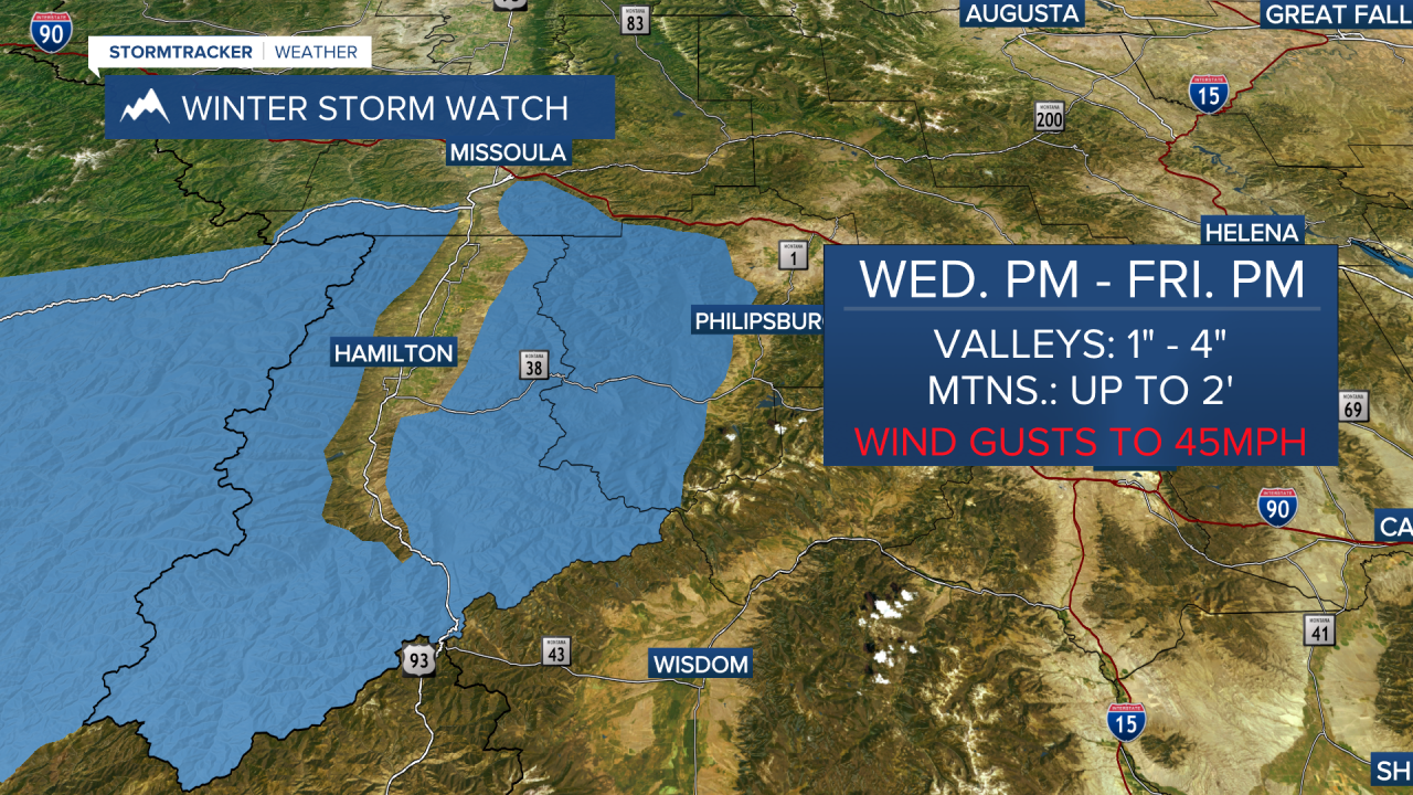
A Winter Storm Watch has been posted for the Bitterroot/Sapphire Mountains from Wednesday night into Friday night where snow could create some travel troubles.