


MISSOULA — High pressure that has dominated the weather this week is breaking down today as a system approaches from the southwest.
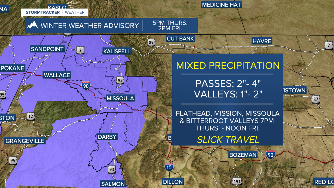
Precipitation should hold off until after 4pm and continue into Friday morning. With numerous valley inversions in place, freezing rain is likely - although things may start off as all snow before the warmer air associated with the main system advects in and begins to mix.
Winter Weather Advisories are in place from Thursday evening into early Friday morning as the NWS warns of impacted travel both on foot and roadways.
Expect a brief lull Friday night into Saturday, but patchy, freezing fog will be possible where clouds break up the most.
A southwesterly flow continues Sunday with scattered snow and mixed precipitation and highs in the low 40s.
Snow levels look to fluctuate next week as a trough moves into the region… bottom line: things look to stay active and slightly warmer than normal. Stay tuned!
