
MISSOULA — Winter-like weather continues to develop from north to south across the region Sunday as colder air arrives at the same time a large push of Pacific moisture enters.
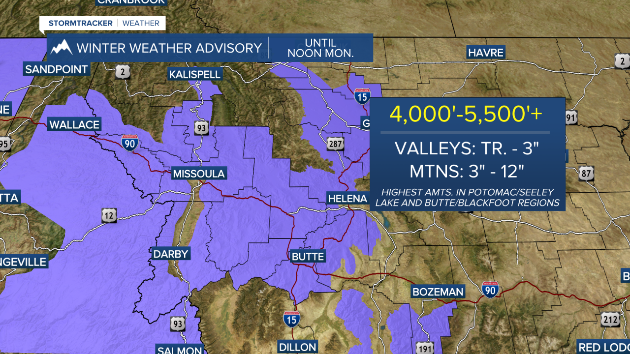
Winter Weather Highlights are in effect until noon Monday and are as follows:
Winter Weather Advisories for Flathead/Mission Valleys, Potomac/Seeley Lake Region (4,000'+), Lower Clark Fork Region (4,500'+), Butte/Blackfoot Region (5,000'+) & Bitterroot/Sapphire Mountains (5,500’+).
Winter Storm Warning for the West Glacier & Kootenai/Cabinet Regions (all elevations).

The most widespread and significant impacts are expected from Sunday night through Monday morning. A period of steadier, accumulating snow will create winter travel conditions in the high terrain and over mountain passes. Snow will also fall in valley locations with a trace to a few inches possible. The higher valley totals are still expected in northwest Montana and all along the Divide. Snow, along with wind and below freezing temps, will increase the risk for icy conditions.
Speaking of winds, they will also increase and become very gusty across the entire region overnight into Monday. Northeasterly wind gusts of 40 to 50mph are expected, especially through channeled terrain in the eastern Flathead Valley, southeastern portions of Flathead Lake and through the mountainous terrain. A High Wind Warning has been issued for these areas until noon Monday. Key impacts include the potential for power outages, falling trees and even potential dock damage along the southern shores of Flathead Lake. The winds will also drive morning wind chills down into the teens and 20s.

Snow showers will linger through the day on Monday, but the intensity is expected to decrease by the afternoon with a few sun-breaks.
There’s a chance for another very light round of snow showers Tuesday morning. The colder airmass now in place will slowly moderate from Tuesday onward, but temps look to stay below average in the upper 40s to mid 50s.
As of now, the weather pattern looks unsettled with additional chances for showers later in the week.
