


MISSOULA - A strong cold front and associated system have moved through western Montana today allowing for thunderstorm development, gusty winds (45-55mph range at times), heightened fire danger and now, lowering snow levels!
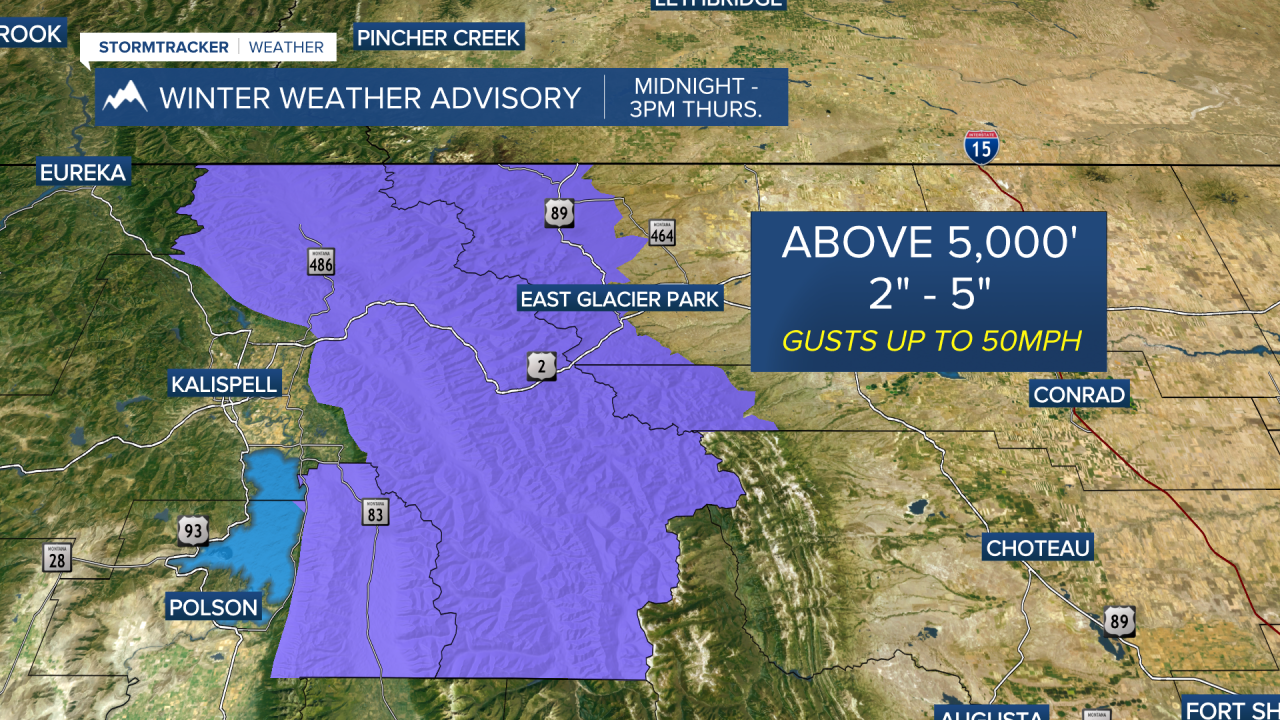
As the low pressure system moves through the region tonight, the bulk of the precipitation will mainly be confined to northwest Montana. Snow levels will drop to around 5,000' tonight so the higher terrain should anticipate snow accumulation by Thursday morning - especially in the West Glacier Region where a Winter Weather Advisory is in place. Some of the highest peaks could see half a foot to a foot of new snow.
Thursday will showcase decreasing clouds with breezy conditions (25-35mph) across western Montana with generally quieter conditions as a westerly flow sets up. Highs will run near to slightly below average Thursday and Friday in the upper 50s to low 60s with an isolated shower perhaps developing.
Another strong (& pretty chilly for this time of year) system with even cooler air is likely this weekend. This will allow snow levels to fall further... perhaps to 4,000' with valley highs in the upper 40s to mid 50s. As of now, by Sunday and Monday morning, temps may drop low enough to cause a frost or even freeze which could damage sensitive plants.
