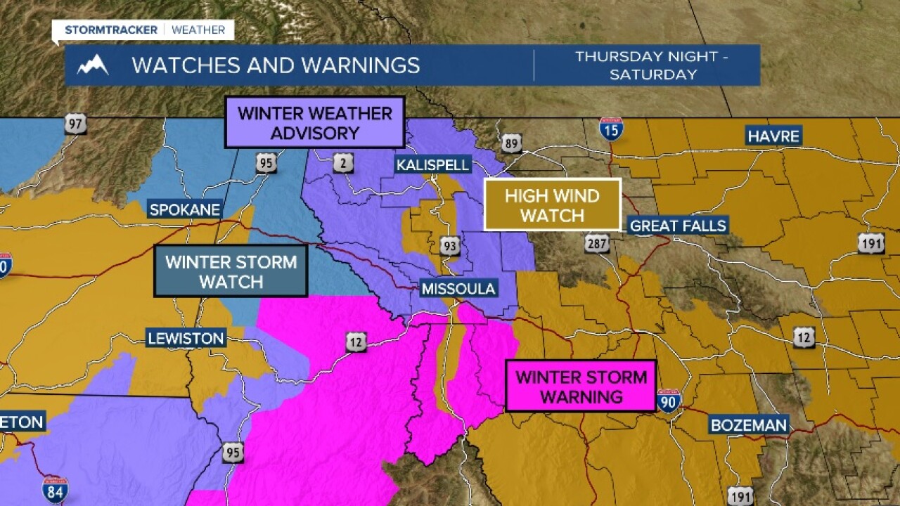
MISSOULA - *An Atmospheric River brings abundant moisture to western Montana from Thursday night into Saturday morning.*
Thursday will be mostly dry and chilly with highs in the 30s.
Tonight, a low-pressure system packed with Pacific Ocean moisture will bring snow to all elevations into Friday morning.
All valleys will have a chance to wake up to snow along with a trace to a couple of inches on the ground.
By the afternoon, temperatures will warm and snow will transition to rain/snow then all rain.
This will continue for valley locations into Saturday morning.
Mountains will see a lot of snow this weekend, especially mountains along the Montana/Idaho border.
Elevations above 5,000 feet will see 1-to-3 feet of snow through the weekend.
Lookout, Lolo and Lost Trail passes will become snow-covered with difficult travel through the weekend.
Another item to watch will be for very strong winds Saturday.
A High Wind Watch is in place for the valleys of western Montana Saturday with wind gusts of 50-to-60 mph possible.
Locally higher gusts up to 70 mph will be possible for the Bitterroot Valley and locations around Georgetown Lake, Philipsburg and Butte.
By Saturday afternoon, snow levels will come back down to valley floors with more snow of a trace to a few inches possible once again in the valleys.
Looking at next week, the coldest air of the season will move in.
Sunday will see scattered snow showers with highs in the 30s.
By Monday, arctic air will drop highs into the teens and 20s with lows in the single digits or below zero.
Expect this to stick around through at least Wednesday with light snow showers continuing.


