


MISSOULA - We'll start the work week off on a partly sunny and warm note, but Tuesday will usher in changing conditions from the northwest to southeast in the form of showers and eventually a cold front by Wednesday morning... in all honesty, it's a mini and quick moving atmospheric river (subtropical moisture originating from the Hawaii-area).
With that front, windy conditions are expected with a 30% to 50% chance of isolated gusts of 40-50mph. The likeliest locations to see this potential are along Highway 2 west of Kalispell towards Libby and into Glacier National Park as well as southwest Montana and along the Divide. Highs Tuesday will range from the upper 40s to low 60s from NW to SE... upper 40s to mid 50s Wednesday... and 40s for Thursday.
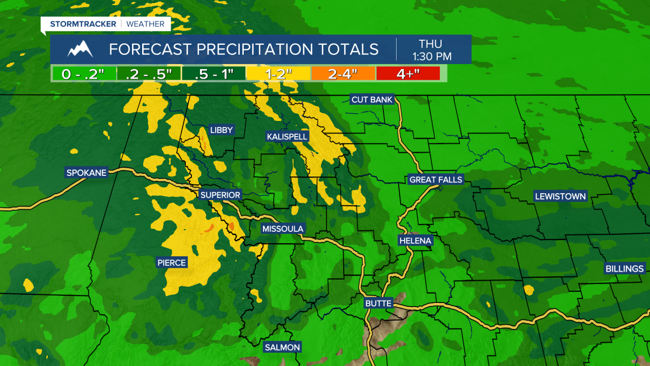
Generally, valleys could pick up a few hundredths of an inch to a couple tenths with the higher end being closer to the Idaho border and in northwest Montana. Most mountains will see 0.50", but the highest terrain along the Idaho border, northern Rocky Mountain Front, and in the Cabinets, Missions, Swans and the Flathead Ranges could see up to an inch (maybe 1.50").
Snow levels will be high to begin with... up to 6,500' to 7,500' by Tuesday night, but drop to valley floors into Thursday. Light snow (maybe 1"-3") will be likely at pass level Wednesday night into Thursday morning. I think the likeliest passes would be Lolo, Lookout & Marias - not so much Lost Trail, MacDonald or Homestake.

Beginning Friday, high pressure looks to build in quickly with mainly sunny skies and highs in the low to mid 50s. Expect more sun than clouds Saturday with mid 50s to mid 60s and partly cloudy skies Sunday with 60s for highs.
