


MISSOULA - High pressure has built across the region allowing for ample sunshine and well above average highs... this will continue for the next day or so before a bigger pattern change arrives!
While the air will feel like summer, NWS reminds folks to be safe around waterways - spring runoff (mountain snowmelt) has left rivers running dangerously high, fast and cold.
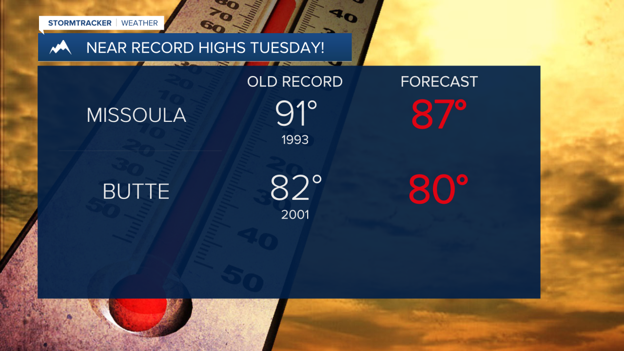
Highs will top out in the upper 70s to upper 80s Tuesday pushing daily records for some.
An incoming system will bring widely scattered showers and thunderstorms for Wednesday ultimately ushering in a larger pattern change to cooler and somewhat unsettled conditions to end the week... Wednesday in particular, though, will be the "battleground" between the two so-to-speak. Fire danger will be heightened due to dry and windy conditions which has prompted a Fire Weather Watch for portions of southwest Montana. This means critical fire weather conditions will exist which could promote the rapid spread of wildfires.
Thunderstorms could also be on the strong side. Isolated, severe storms are not out of the question. Gusty & erratic winds and lightning will be the two primary threats. The threat continues Thursday with partly cloudy skies otherwise and low 60s.
This weekend could be a shock to the system after our warm start to the week. Highs will likely drop into the 50s to low 60s on Saturday and Sunday. This unsettled pattern will cause snow levels to fall. There is a 60% chance they will drop to around 4,500' especially across northwest Montana.
