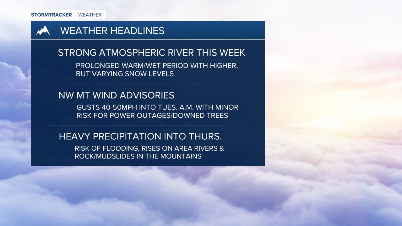


MISSOULA — A prolonged atmospheric river (AR) event is expected to bring periods of heavy rain & wind for the region Monday night through Thursday.
An AR is a narrow, intense plume of subtropical moisture — nothing new to the western United States, but this AR has an incredible amount of moisture, which will be transported into the Pacific Northwest, bringing more ‘bad than good’.
First, for us in Western Montana, the wind — southwest to west winds will be strong late Monday afternoon through Tuesday morning. There is a minor concern for localized tree damage and power outages.
With our currently saturated ground across many of our valleys, downed trees are possible. The strongest winds will be in Northwest Montana, and we do have some wind advisories in place there:
- Kootenai/Cabinet & Lower Clark Fork Regions (8 p.m. Monday- 8 a.m. Tuesday): Southwest 20 mph to 30mph with gusts up to 45 mph (higher in mountains).
- West Glacier Region (11 p.m. Monday - 11 a.m. Tuesday): Southwest 25 mph to 35 mph with gusts up to 50 mph.
- Flathead/Mission valleys (11 p.m. Monday - 8 a.m. Tuesday): Southwest 15 mph to 25 with gusts up to 45 mph.
Next, the precipitation. Rising snow levels will lead to a ‘rain-on-snow’ event for elevations below 7,000’ Monday night into Tuesday morning.
Precip. rates should let up a bit on Tuesday, early afternoon, before a secondary surge of moisture arrives Tuesday night into Thursday. During the second surge, snow levels will be lower: ranging from 4,000’ to 5,000’ north of I-90, to 5,000’ to 7,000’ south of I-90, with the highest snow levels across Lemhi County, Idaho.
I will say, travel uncertainties exist for the secondary surge in the valleys, but pass level impacts are likely.
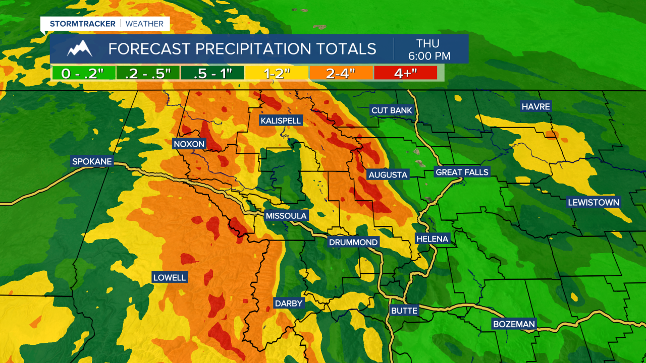
By Thursday, significant liquid precipitation totals are forecast with 1” to 3” in the valleys (locally higher) and 4” to 8” in the mountains (highest over mountain crests along the MT/ID border and into GNP/the Bob).
Snowmelt runoff with rainfall of this caliber isn’t a good thing. Landslides in areas of steep terrain and minor flooding in urban and poor drainage areas is very possible. Storm drains and ditches will likely become clogged with debris and we’ll likely see sharp rises on area waterways. A Flood Watch has been issued for Mineral, Sanders, Lincoln, Flathead & Lake counties from Monday afternoon through Thursday morning, where some of our highest totals are expected.
Needless to say, expect well above average highs in the 40s this week.
This is a very serious set up, so updates will follow from us here in the StormTracker Weather Center.
Watch the 24/7 StormTracker Weather stream below:
