


MISSOULA - Our high intensity, long duration atmospheric river event continues, although the wind threat has come and gone for western Montana.
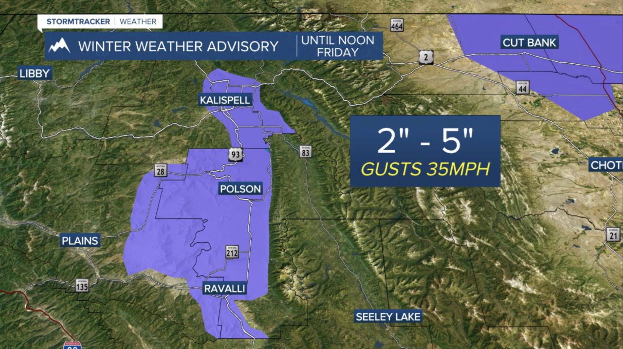
Our focus now shifts towards the continuation of significant mountain snow and a mixed bag of precipitation for our valleys... especially across west central Montana. With that said, we can expect light to moderate accumulations generally along and north of I-90 overnight into Friday. A Winter Weather Advisory has been issued for the Flathead & Mission Valleys until noon Friday. Flathead Valley will continue to see impacts tonight with impacts spreading south through the Mission Valley by Friday morning.
Along the I-90 corridor, including Missoula, the forecast is a little trickier. A slight lowering of snow levels tonight could mean 1"-4" of heavy, wet snow for Sanders, Mineral, Missoula, Granite and Powell Counties. Given the potential for slushy accumulations, NWS Mssoula says winter weather advisories may be required. Highs Friday will range from the mid to upper 40s in the Bitterroot to the upper 30s in NW Montana. Valleys located in these Winter Storm Warnings will see higher potential snowfall totals:

Needless to say, avalanche danger is incredibly high and will continue to be so with warnings in place.

Another opportunity for light valley accumulation & slick roads is on tap Saturday as another cold front brings in even cooler air.
Sunday will feature a quiet, chilly day with highs in the upper 30s and mostly cloudy skies... another quick moving system moves in for Monday with 50s/60s & some sun beginning Tuesday!
