Showers (maybe even a rumble or two of thunder!) will continue to increase across the region Wednesday, but our main event arrives overnight!
The cold front we've been talking about all week will sweep through early Thursday morning allowing snow levels to crash down to valley floors (near 3,000'). The valley snow potential for western Montana will vary greatly due to several factors including warming ground temps and a higher sun angle this time of year... accumulation will be likely for our higher elevated valleys, however. Valleys that do see that will see a heavy, wet nature of snow which will likely build up on trees, creating potential tree damage and power outages.
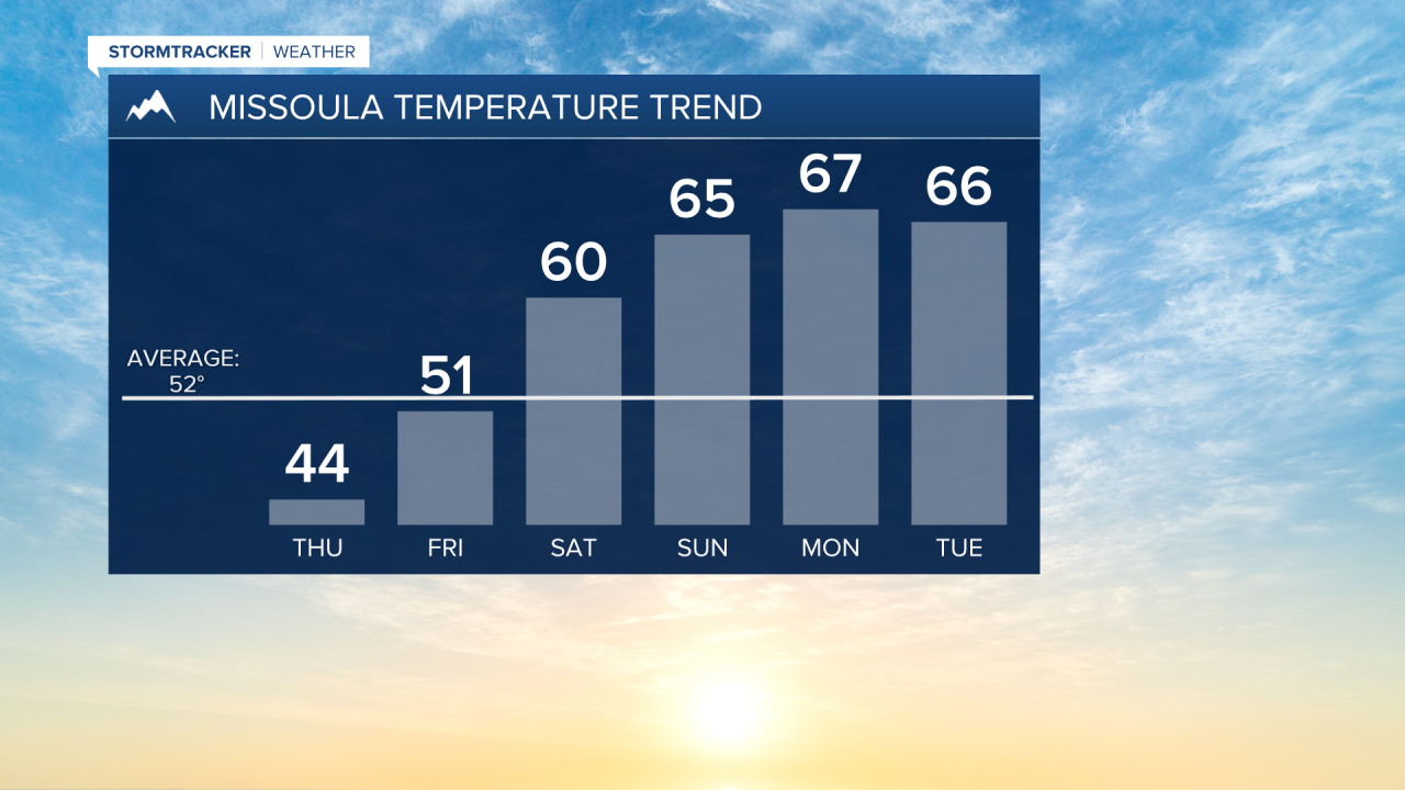
Winter Weather Advisories have been issued and begin at midnight for the Bitterroot/Sapphire Mountains and at 6am Thursday for the West Glacier, Potomac/Seeley Lake and Butte/Blackfoot Regions. They will all expire by late Friday morning. Highs Thursday will top out in the low 40s with breezy conditions otherwise.
Precipitation winds down late Friday morning with a partly cloudy evening on tap and highs in the upper 40s to low 50s.
As of now, the upcoming weekend will start of sunny with mid 50s to around 60° and end partly sunny with upper 50s to mid 60s continuing into early next week.