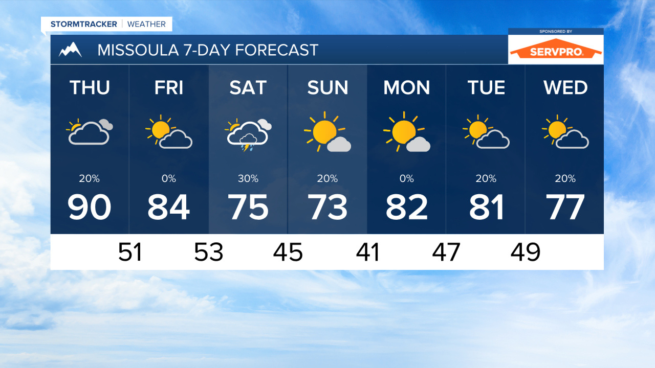
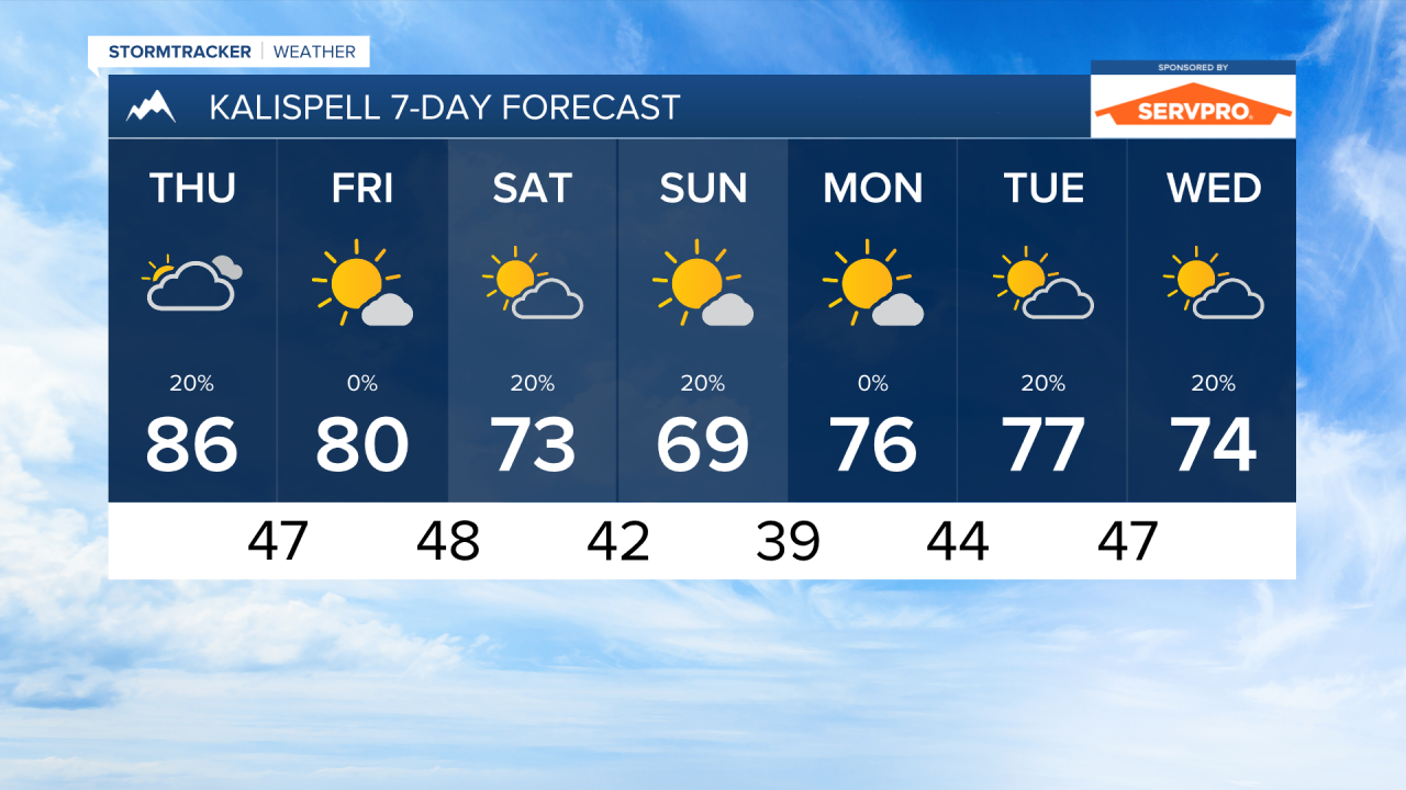
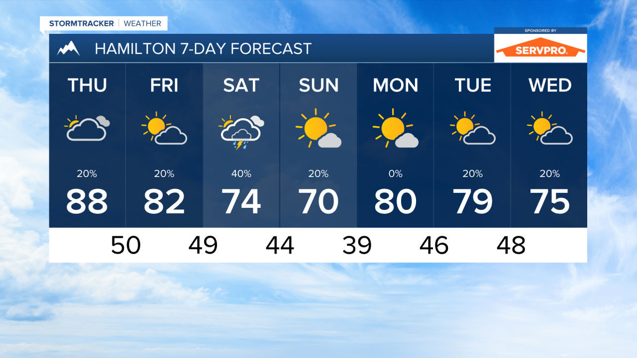
MISSOULA — A storm system coming in from the Pacific will bring much cooler air for the last weekend of August across the state. The area of low-pressure may also bring some rain showers back to western Montana on Saturday.
Scattered thunderstorms are moving through our area Wednesday afternoon. Thursday will be mostly dry before another wave of Monsoonal moisture comes in to southwest Montana on Friday night. This moisture may bring some light rain to the southern Bitterroot Valley, but everyone else should remain dry until scattered thunderstorms pop on Saturday.
Air quality will be variable at times through the rest of the week. Local fires will be producing smoke each afternoon until more significant rain comes into the picture. Expect "good" to "moderate" air quality conditions overall.
Temperatures will be decreasing through the rest of the week. Highs will reach the upper 80s and low 90s on Thursday, but a cold front will begin to influence the area by Friday night. On Sunday, highs will only reach the 60s and 70s.
——————————————————————————————————————————
MONTANA WEATHER ALERTS:
NONE
——————————————————————————————————————————