


UPDATE
The Deer Fire, which sparked Friday, continues to burn near Missoula and Turah as crews work to contain the blaze.
Check out the Sunday update from the Deer Fire:
As of Sunday midday, the fire has burned 101 acres with 124 personnel on the scene.
Saturday's gusty winds caused small spot fires; however, fire activity is moving away from values at risk in Pattee Canyon.
The fire is burning primarily in timber across steep, rugged terrain.
Forest Service Road 2127 is closed from its intersection with Deer Creek Road. Three other roads that connect to 2127 have also been closed, as well as Trail 512.
Unless rescinded earlier, the closures will last until 11:59 p.m. on July 27.
Crews are working to construct a fire line with aerial support as heavy equipment increases access to the fire.
The public is asked to remain out of the area while crews work. This includes a temporary flight restriction for any drones.
The cause of the fire remains under investigation.
This story was reported on-air by a journalist and has been converted to this platform with the assistance of AI. Our editorial team verifies all reporting on all platforms for fairness and accuracy.
ORIGINAL REPORT
The Deer Fire continues to burn on the Lolo National Forest's Missoula Ranger District.
The fire, which broke out in the evening on July 18, sits 3 miles southeast of the Crazy Canyon Trailhead and 2.5 miles north of Miller Peak.
Fire activity is moving away from values at risk in the Pattee Canyon area. It is burning primarily timber in steep, rugged terrain.
The Lolo National Forest says spot fires resulted from Saturday's wind.
Fire managers added that Sunday's weather looked to bring moderate fire behavior with isolated showers and 20 mph winds from the west possible in the afternoon.
As of Sunday morning, the blaze has burned 101 acres with 124 personnel on the scene.
According to Inciweb, road and trail closures have been implemented for the following:
- Forest Service Rd. 2127 (from its start/intersection with Deer Creek Road (County Route 533) to its end)
- Forest Service Rd. 19075 (from its start/intersection with Rd. 2127 to its end)
- Forest Service Rd. 16779 (from its start/intersection with Rd. 2127 to its end)
- Forest Service Rd. 17756 (from its start/intersection with Rd. 2127 to its end)
- Forest Service Trail 512 (from its start/intersection with Rd. 17756 to its end/intersection with Rd. 2127-2)
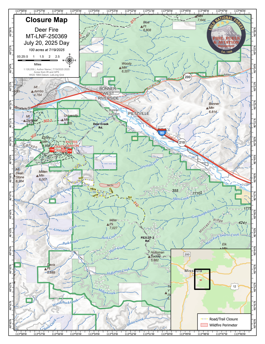
Unless rescinded earlier, the closures will be in effect from 9 a.m. on July 20 through July 27 at 11:59 p.m.
Firefighters on the ground are engaged in suppression efforts and have established an anchor point in the fire area.
On Sunday, crews worked to construct a line on the northwestern edge with aerial support.
Heavy equipment continues to increase access to the fire and look for opportunities for dozer line construction.
Five crews, four large air tankers, three helicopters, three engines, two dozers, and one water tender have been ordered for further assistance.
The public is asked to remain out of the fire area as crews work. This includes a temporary flight restriction for any aircraft or drones.
The cause remains unknown and is under investigation.
