

MISSOULA — Heads up if you're spending time outside over the next several days!
Watch your weekend forecast:
Hazy morning sunshine followed by afternoon thunderstorms this weekend
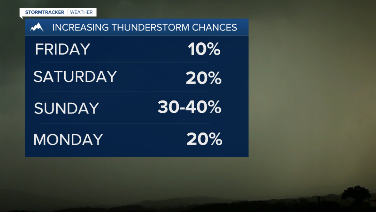
Thunderstorm chances are on the rise, starting today and gradually spreading from south to north through early next week. If you’ve got outdoor plans, keep an eye on the sky — if you hear thunder, go inside.
What to Expect
- Each day will bring a growing chance of storms, especially in the afternoons.
- Strong winds (50+ mph) could kick up around any thunderstorm, especially from today through the weekend.
- Today’s storm zone includes Lemhi County and parts of southwest Montana. By Saturday, storms could reach the Bitterroot Valley and areas along I-90 east of Missoula. Expect even broader coverage by Sunday.
Weekend Concerns
- Outflow winds — strong gusts that rush out ahead of storms—are a big concern. Areas like Georgetown Lake, Deer Lodge, Butte, and Lemhi County could see gusts over 50 mph on Friday.
- Saturday afternoon could bring a surge of strong southerly winds through the Bitterroot Valley.
Looking Ahead to Next Week
- A shift in weather patterns will draw in more moisture from the Southwest, raising the chances for heavier rain, especially by midweek.
- This could increase the risk for localized flash flooding, runoff, and debris flows in steep terrain or areas with recent wildfire burn scars.
- Additional hazards may include frequent lightning, small hail, and strong wind gusts.
- Temperatures will remain in the 80°-90° range over the next week without much change.
Watch the 24/7 StormTracker Weather stream below:
