
MISSOULA - A pattern change begins Thursday into Friday as a back-door cold front slides south and west out of Canada into the Treasure State.
Watch the forecast:
While this won’t be a rainy cold front, it will bring three things:
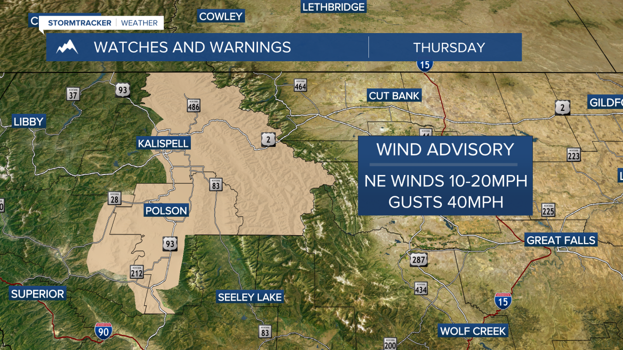
- East to northeasterly winds in the 10-20mph range (gusts up to 40 mph,) which will likely create choppy conditions on area lakes by Thursday evening. A Wind Advisory has been issued for the West Glacier Region and the Flathead/Mission Valleys until midnight.
- Heightened fire danger due to hot, dry and windy conditions
- A temporary increase of smoke/haze from wildfires burning in Alberta and Saskatchewan. And we’re already seeing poor air quality (with an Alert in place) across western Montana as of Thursday morning!

Highs will begin to drop, too… looks like mid 80s today and low to mid 80s Friday with ample sunshine (& haze… cough, cough).
Models are coming into much better agreement with this upcoming weekend’s weather… our current ridge will shift eastward and out of here, allowing for a southwesterly flow to return. This will allow slightly cooler air to move in, but more importantly, the chance for showers and even a few thunderstorms. Most will be in the southwest quarter of the state Saturday with more widespread (but still isolated) activity Sunday. Highs will be in the mid 80s Saturday & Sunday before dropping into the upper 70s to low 80s Monday.

The extended outlook for much of next week is fall-like: scattered showers, embedded thunderstorms and highs in the low 70s!
Watch the 24/7 StormTracker Weather stream below:
