

MISSOULA — Our weekend weather pattern is carrying over into this week with more thunderstorms, isolated showers, and hot temperatures.
The setup in the atmosphere is ideal for some summer storms.
We have low pressure hanging off southern Alaska, high pressure in the southwest states, and a cold front poised to drop out of Canada.
Watch the forecast:
Montana is stuck in the middle of these three features. This setup means that we'll see a recurring pattern of thunderstorm chances through the work week.
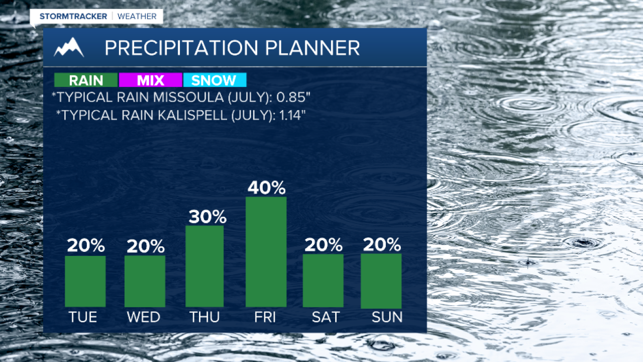
Chances will remain between a low-moderate risk — 20% to 40% — until Thursday and Friday, when the chances elevate slightly.
The main threats with these storms include lightning, gusty winds, small hail, and possible heavy rain.
Southwest Montana will get hit more often at the beginning of the week, and then Northwest Montana will have its turn later on.
Storms are likely to start up each day in the late afternoon and continue until dusk.
Be weather aware this week and stay cool. Temperatures will continue to be barely above average in the upper 80s to lower 90s.
Watch the 24/7 StormTracker Weather stream below:
